Training and knowledge sharing


Tailor-made training and education
At Blue Team Intelligence, we offer customised training programmes that meet the specific needs and goals of your organisation. Whether it involves integrating existing materials or developing a completely new approach, our content is tailored to the participant’s real-world experience.
We also offer ready-to-use training courses that can be deployed immediately, enabling your organisation to learn quickly and effectively. Our programmes are designed on a strong foundation of domain knowledge and technical expertise. Translated into practical, applicable insights for you and your team.

-
Geo courses
From introductory courses on geography and geographic products to the use of remote sensing, geo-AI, and Open Source Imagery for intelligence purposes. We offer a wide range of courses in geographic (intelligence) analysis.
-

Intelligence courses
We offer courses that help your organisation better identify and develop its information needs. In addition, we provide guidance on how to effectively manage the collection of that information.
-

Workshops
We offer workshops and serious games focused on intelligence focused on intelligence and geographic analysis. Our aim is to apply and build on existing knowledge, while also raising awareness of aspects participants may not have encountered before.
Overview all courses
Geo courses
Intelligence courses
Workshops
Geo courses
Basic Geo Analysis (2 × 4 days)
In this course, entry-level geo-analysts working in the Public Safety and Security (PSS) domain and within integrated partnerships learn how to incorporate the geographical dimension into analysis and investigations, using Geographic Information Systems (GIS), spatial data, and analytical methods. The course is intentionally not focused on operating a specific GIS platform. Instead, it emphasises understanding the context and rationale behind spatial analysis. The actual analysis are carried out in a GIS environment, using examples and assignments tailored to the participants’ professional field.
Geo Awareness (2 days + optional 1 day GIS)
This course introduces analysts, field professionals and decision-makers within the PSS domain and within integrated partnerships to the influence of geography within their work: How spatial factors play a role in various forms of crime, but also how they can support investigations and analysis. Participants learn to identify spatial patterns, relationships and indicators.
This course is deliberately designed to work without GIS software, using freely available tools and purpose-built apps to demonstrate the value of the geographic perspective. However, an extended version including the use of GIS is available upon request.
Remote Sensing (3 days)
This remote sensing course is an advanced course aimed at geo-analysts within the PSS domain and within integrated partnerships who want to deepen their knowledge of sensor-based data collection and analysis from aerial or satellite platforms. Participants explore the electromagnetic spectrum and how different frequencies are used to detect signals. Through theory, compelling real-world use cases, and practical assignments linked to their operational context, participants discover how remote sensing can enhance their analytical capabilities. GIS tools are used in the exercises.
Spatial Analysis Models (2-3 days)
How can you integrate and automate different (geo)analytical processes within GIS or a notebook environment? That’s the central question of this course. Using real-world use cases and hands-on assignments, geo-analysts within the PSS domain and within integrated partnerships learn how to apply spatial modelling techniques in practice.
Introduction to IMINT (Imagery Intelligence) (2 days)
With a massive volume of freely available imagery now accessible worldwide, this course teaches analysts, field professionals, and decision-makers within the PSS domain and within integrated partnerships how to interpret aerial and satellite images. It also covers social media, which is filled with user-generated content rich in valuable information. Participants learn how to collect imagery from various platforms and sensors and how to analyse it in a structured way, through practical examples and assignments.
Spatial Statistics (3 days)
This course enables participants within the PSS domain and within integrated partnerships to analyse spatial characteristics, patterns, clusters, relationships and anomalies in data using GIS. Like other courses, it is not centred on mastering a particular GIS platform, but on understanding the analytical context. Participants then perform analyses in GIS, working with practical examples and assignments drawn from their own operational environment.
Raster Analysis (3 days)
In addition to structured interpretation of imagery, raster data can be analysed using spatial statistical techniques. This course teaches participants how to carry out raster analysis, using methods and tools relevant to their day-to–day work. Exercises and examples are grounded in practical applications from the participants’ own professional context.
OSINT Geolocation (2 days)
Analysts in the PSS domain and within integrated partnerships increasingly encounter images or video material to criminal activities. But how can you determine where this content was captured? Using real-world examples and assignments, participants learn a structured method for identifying the exact location of a photo or video.

Intelligence courses
Developing Information Requirements (2x 4 days)
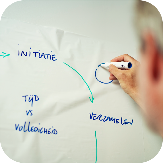
The practice of intelligence is cyclical, and everything starts with a solid research question. But how do you move from this question to a sound investigation? And in a world where much remains hidden from view, how can you still observe the right things to draw meaningful conclusions about your research or case?
This course provides a structured framework to help participants move from an initial research question to a well-founded collection and analysis plan. How do you construct a solid theoretical model? Which scenarios should you consider, and what indicators do you need to observe in order to determine which scenario is unfolding?
We use real-world use cases and practical assignments that reflect the participants’ professional context, ensuring that the lessons learned can be directly applied in practice.
Information and Collection Management (duration to be agreed)
To meet an information requirement, it is, logically, essential to collect and secure relevant data. Who is responsible for gathering which data? When do we need each piece of the puzzle? But also: when does a specific piece of information become irrelevant or obsolete, meaning it no longer needs to be collected?
During the Information and Collection Management course, we delve deeper into both pillars. You will learn how to develop a solid collection plan, what preconditions need to be in place, and how to track and manage incoming information. Additionally, we’ll teach you how to ensure that the information you need is actually being collected.

Workshops
Where could she be?
In this workshop, you step into the shoes of a geographic analyst for the Veteranen Search Team, a foundation that works alongside the police for missing persons. In a race against the clock, you’ll use an intuitive app to analyse incoming information and identify the area with the highest likelihood of locating the missing individual.
Geographic synthetic drug indicators
This workshop focuses on the added value of geographic indicators in identifying undermining activities and criminality. Using printed maps and aerial imagery, participants identify geographic indicators of synthetic drug labs and mark them accordingly. By combining the different data layers, a picture emerges highlighting suspicious locations.
Where is the lab?
Combating organised crime requires a coordinated effort between investigation and enforcement. In this workshop, participants experience how to prepare a site inspection based on limited information. What information is needed, and what should be communicated to the officers conducting the inspection?
Next, participants actually carry out the inspection. What should you look out for during a site check? Which information needs to be recorded, and how can this be done so that the analyst receives the right information?
Battle for Biddinghuizen
In this workshop – developed in collaboration with the NIA – participants delve into the feud between two competing installation companies in Biddinghuizen. Using this case study, they work on building forward-looking scenarios and everything that entails.
Collaboration with the National Intel Academy
![]() Blue Team Intelligence collaborates with the National Intel Academy. Looking for more training programmes in the field of intelligence? Be sure to check out NIA’s full range of courses.
Blue Team Intelligence collaborates with the National Intel Academy. Looking for more training programmes in the field of intelligence? Be sure to check out NIA’s full range of courses.
A training programme tailored to your organisation?


Let’s map out your information needs together.