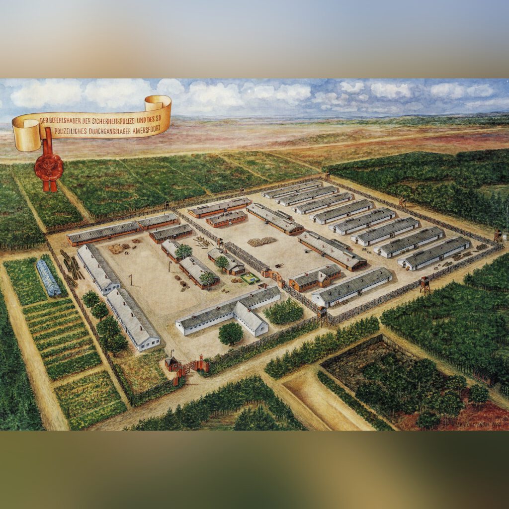
Reconstructing the location of a resistance fighter’s grave using spatial analysis
At the end of the Second World War, a resistance fighter was executed by firing squad at Kamp Amersfoort. Several attempts have been made to locate and excavate his field grave, but without success. During a search in 1947, at a location pointed out by one of the members of the firing squad, two photos were taken.
Finding the grave is very important, so that the resistance fighter can finally be given a respectful resting place. To make this possible, the exact location of the grave needs to be established.
To this end, a study was set up to determine the exact location where the two photos were taken. By combining visible elements in the photos with historical aerial photographs, drone imagery and spatial analysis, it may be possible to reconstruct where the grave is located.
The main research question is:
Where were these photos taken?
In addition, the study examined:
- Whether both photos were taken at the same location
- Whether both photos were taken at the same moment
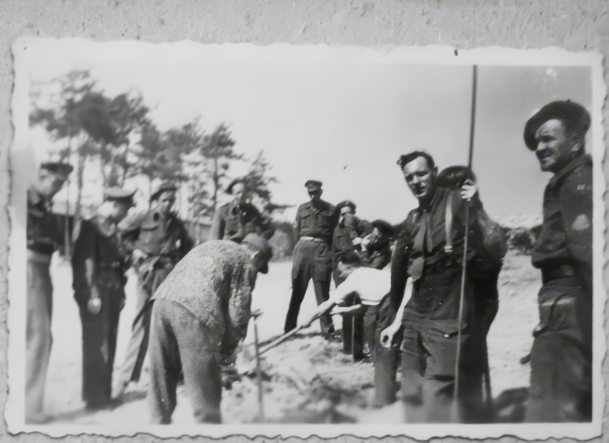
Photo 1
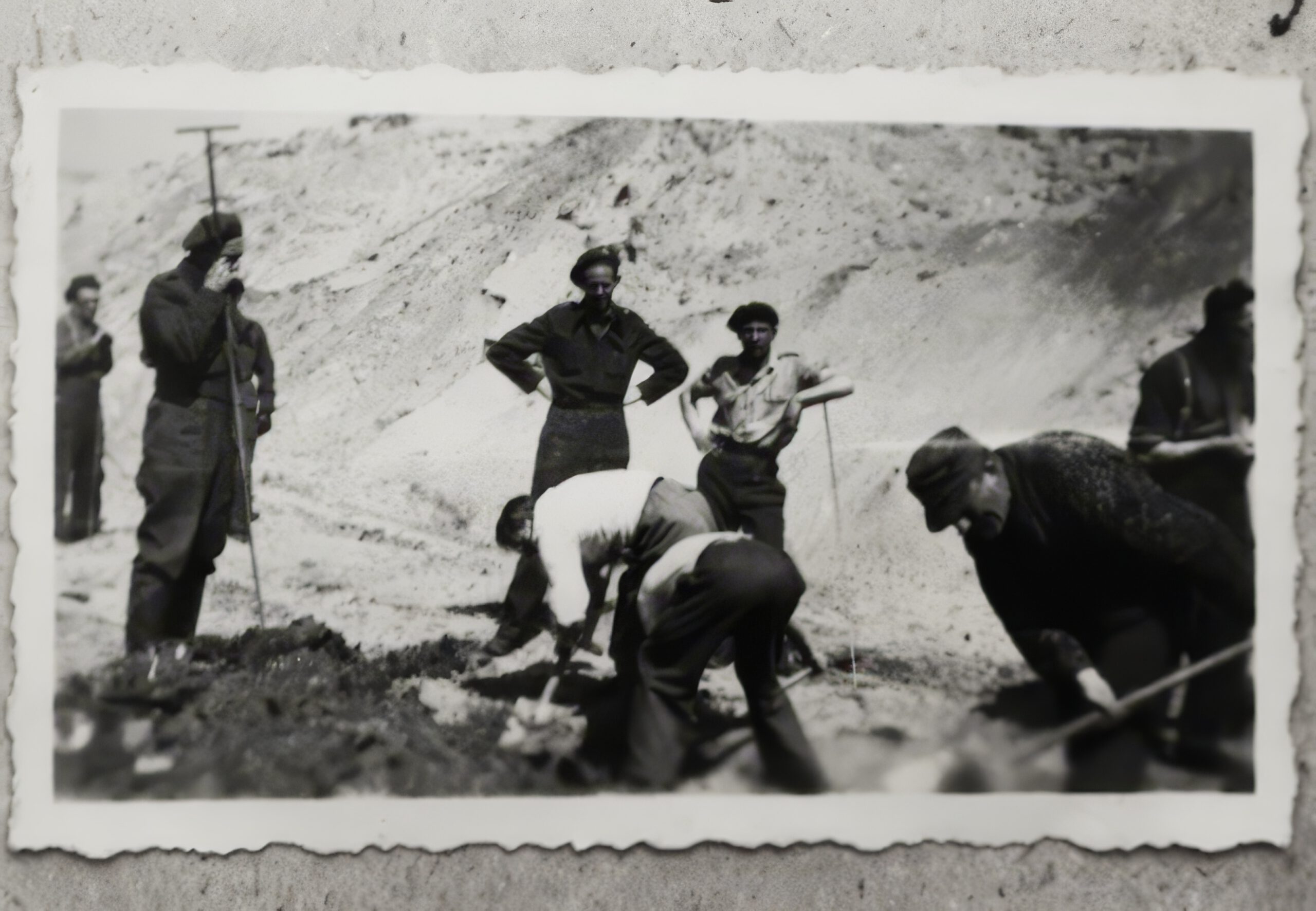
Photo 2
Visible elements
To determine where the photos were taken, reference points are needed. Both photos show various landscape features that can be used for this purpose.
These features were identified so that they could later be placed on a historical aerial photograph and serve as spatial reference points.
Which recognisable features are visible in the photos?
The following features could be distinguished:
- Trees (maritime pines): light green
- Barrack: red
- The mortuary (read the blog post about it): yellow
- Firing range berm: pink
- Front of the low berm: light blue
- Dark patches in the berm: purple
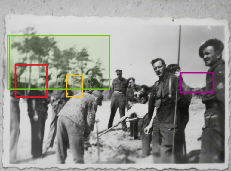
Photo 1 annotated
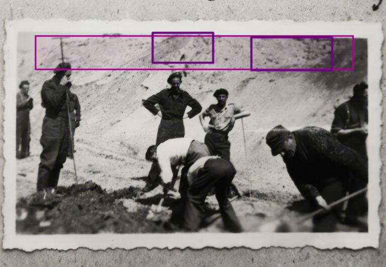
Photo 2 annotated
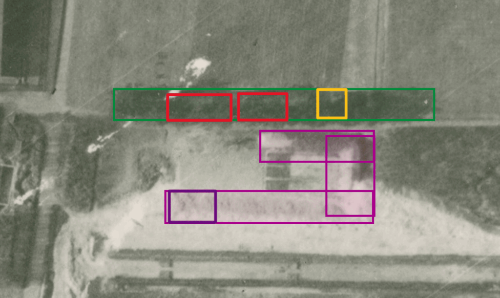
The visible elements in the two photographs
Plotted on a historical aerial photograph, this looks as follows:
Assumptions
To determine where the photos were taken, a number of assumptions are necessary:
- Both photos were taken at the firing range berm at Kamp Amersfoort
- The photos were taken in (approximately) the same year
- The identified features have been interpreted correctly
- There is no significant distortion caused by the camera lens
- The tree with the distinctive branch is the same tree that is still present on the site today

Determining the location of photo 1
Because photo 1 contains several recognisable elements that can serve as reference points, it was decided to determine its location using an angle analysis. This involves identifying specific points in the photograph and translating them to their positions on the map.
The photograph was taken from a viewpoint that meets the following conditions:
- The second barrack is visible
- The mortuary is visible
- The front of the low berm is visible
- The tree with the distinctive branch is located just to the left of the low berm
- The inner corner of the high berm is visible
When these features are marked on the photo, a spatial relationship emerges between the reference points. This leads to an important geometric condition:
The angle between the centre point and the left point must be equal to the angle between the centre point and the right point.
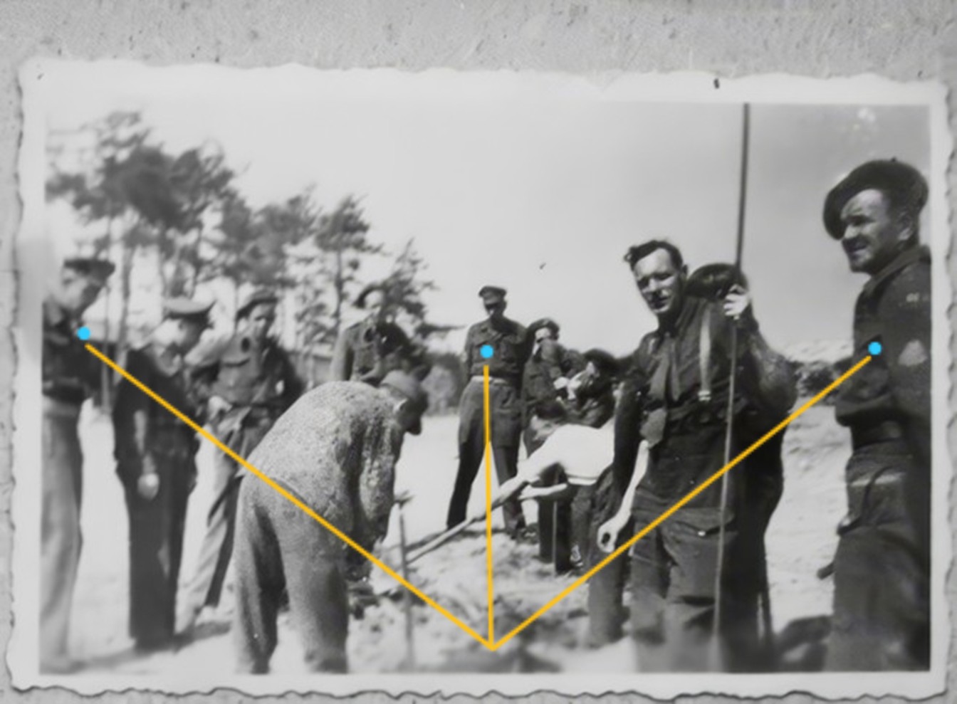 Reference points photo 1
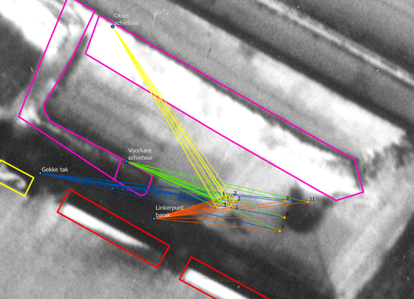
The reference points identified in photo 1 (the left, centre, and right points) can then be translated to their positions on the map.
By placing these points within a spatial context, it becomes possible to reconstruct different viewing directions. From potential camera positions on the map, it can be determined whether the angles between these points correspond to the viewing angle in the photograph.
In other words, we can test from which locations the image in the photograph could geometrically make sense. For each possible position, the following is calculated:
- The angle between the left point (barrack) and the centre point (front of the berm)
- The angle between the centre point and the right point (inner corner of the berm)
The difference between these angles determines how likely a location is.
When the difference is large, the photograph cannot have been taken from that location. When the difference is small, the viewing direction matches the image.

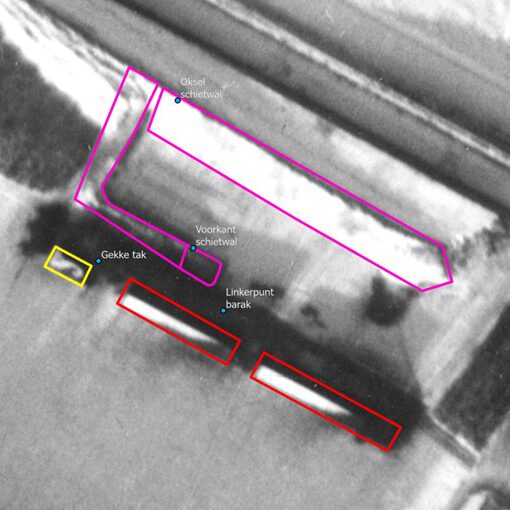
Initial test locations
Using this method, potential camera positions were first examined in the area around the former Kiesgrube.
From these locations, the angles between the reference points were calculated. Although the position of the tree with the distinctive branch relative to the low berm initially appeared to match, the difference between the calculated angles was consistently substantial. As a result, the geometric relationship between the reference points did not match the situation in the photograph.
These locations could therefore be ruled out as unlikely.
Alternative locations
Next, positions closer to the firing range berm were examined.
From these locations, the angles between the reference points corresponded much more closely. In several cases, the difference between the calculated angles was very small. In addition, from these positions the relative position of the tree with the distinctive branch matched what is visible in the photograph: just to the left or just behind the low berm.
This indicates that these locations align more closely with the original viewing direction of photo 1.
Most likely location
The locations where the difference between the calculated angles is minimal form a cluster of possible camera positions.
This area can therefore be considered the most likely location from which photo 1 was taken.
Determining the location of photo 2
Unlike photo 1, photo 2 contains fewer clear reference points suitable for an angle analysis. As a result, the exact viewing direction cannot be reconstructed in the same way.
Nevertheless, a number of features visible in this photo provide spatial clues.
In photo 2:
- Dark patches in the berm can be seen
- The entire berm is visible
- The distance between the excavation site and the berm appears relatively small
These observations give an indication of the position of the camera relative to the berm.
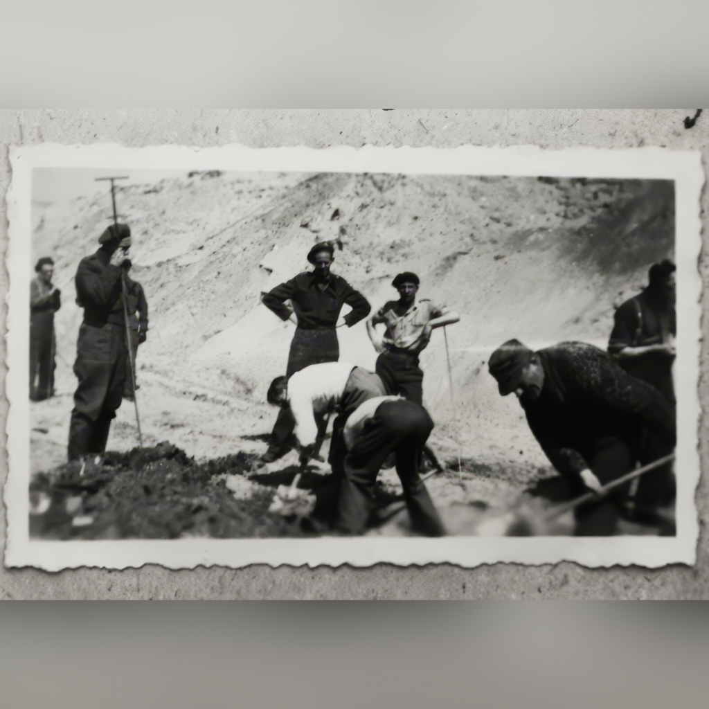
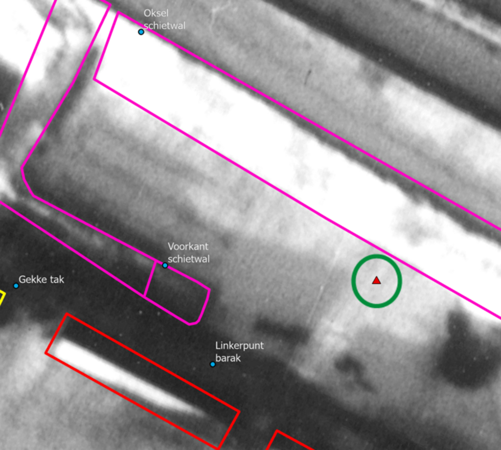
Because the entire berm is visible, it can be assumed that the photo was not taken from a position close to one end of the berm. In addition, the dark patches in the berm correspond to features that are also visible on the historical aerial photograph. This makes it possible to relate the photo to specific sections of the berm.
When the estimated distance to the berm is compared with the map, a location emerges that makes spatial sense in relation to the excavation site.

This location can then be tested using the same method as for photo 1. When the angles between the reference points are calculated from this position, the difference between the angles turns out to be considerably larger.
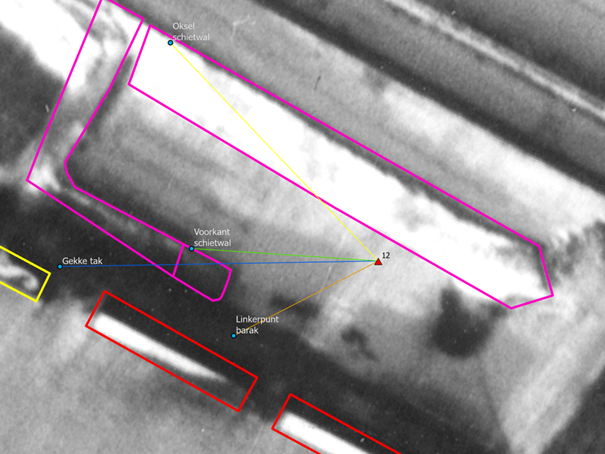
This suggests that the viewing direction of photo 2 differs from that of photo 1.
This supports the possibility that:
- The photos were not taken from exactly the same position
Or:
- A camera lens was used that makes the berm appear closer than it actually is
Both explanations are consistent with the visual features of photo 2.
Were both photographs taken at the same location?
Based on the analysis, it seems quite possible that the two photos were not taken from exactly the same location. It is, however, likely that both images were taken within Kamp Amersfoort.
In addition, the possible use of a camera lens that optically brings objects closer should be taken into account. This could make the high berm appear closer than it actually was, which may affect the interpretation of the viewing direction.
Were the photographs taken at the same moment?
It is likely that both photos were taken at the same moment, as at least two people wearing the same clothing can be recognised in both images.
It is possible that other people in both photos are also the same individuals, although this cannot be established with complete certainty.
The comparison below shows cropped sections of each person from both photos.
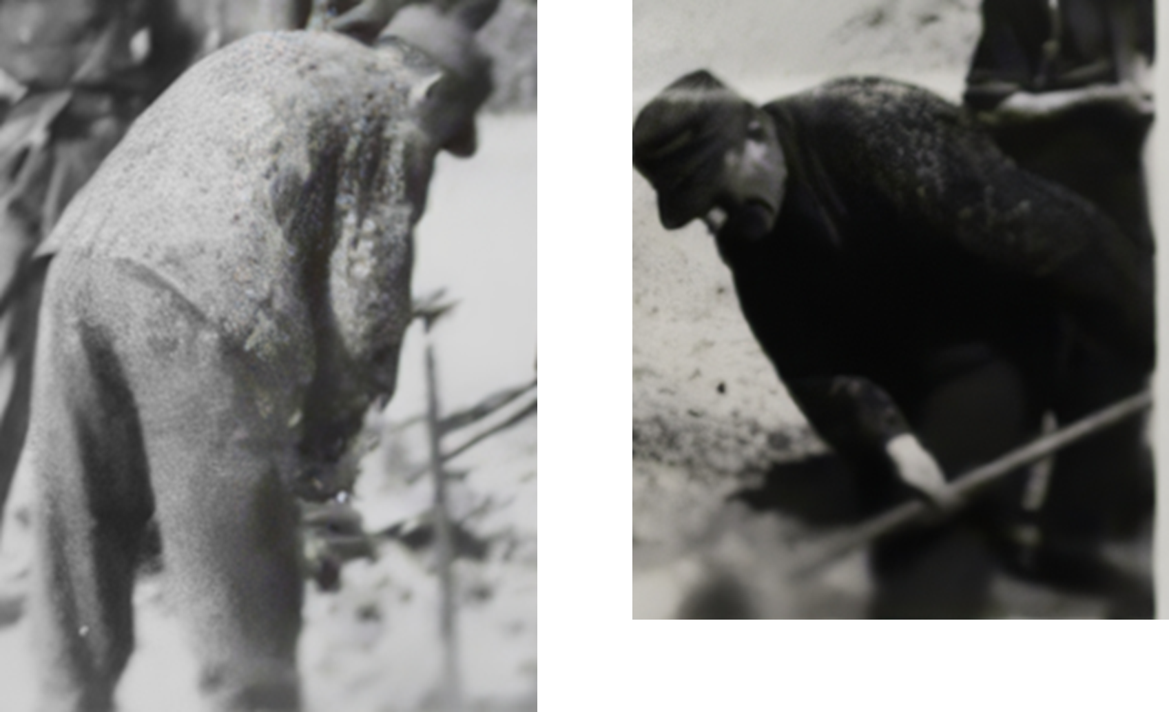 Person 1 |
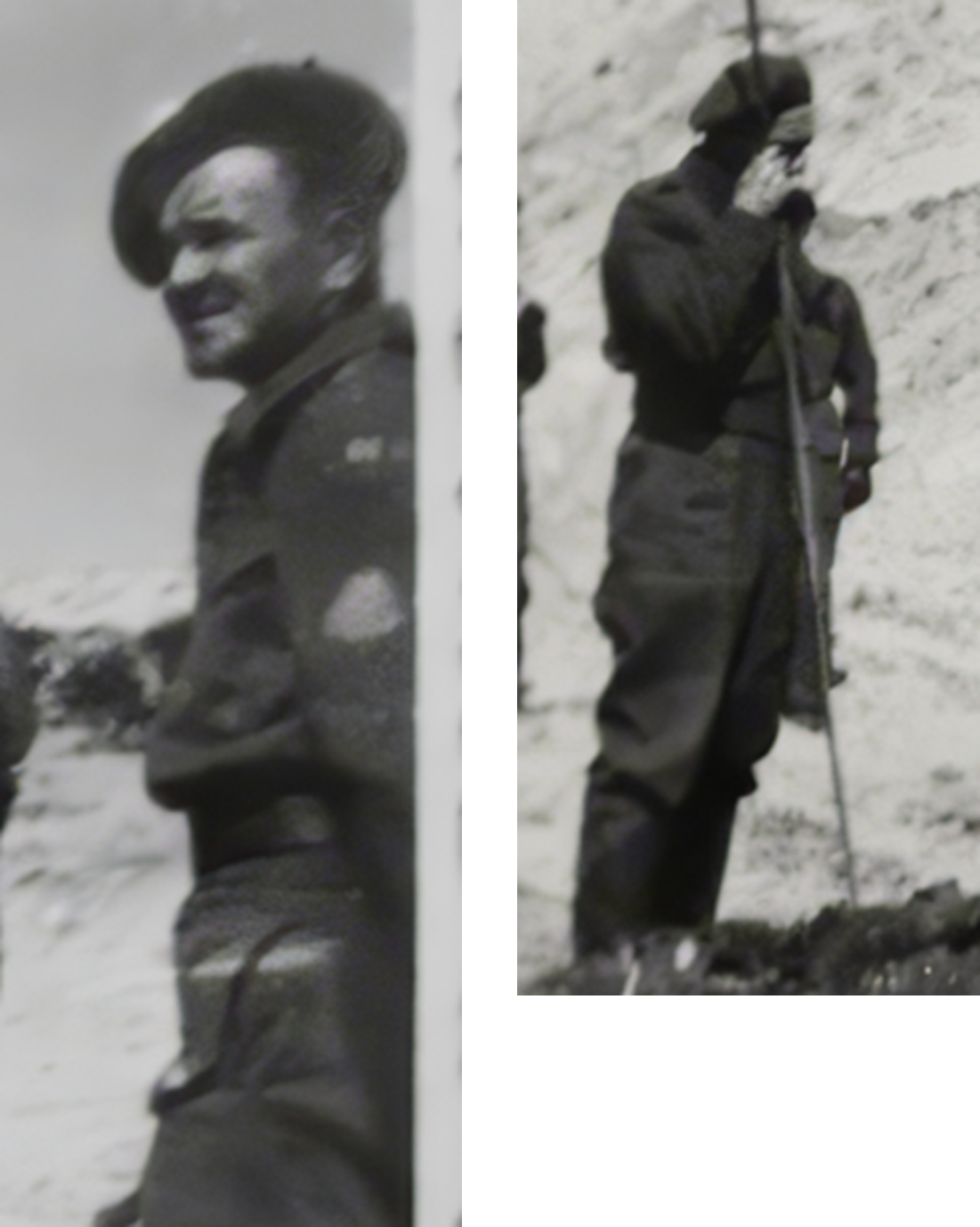 Person 2 |
Conclusion
Based on the angle analysis, a range of possible camera positions for photo 1 could be examined. The differences in angles between the left, centre, and right points provide insight into how well a location matches the viewing direction shown in the photograph.
The most likely location lies within the cluster of points where the difference between the calculated angles is only about one degree.
By combining these locations, a defined area could be established that best corresponds to the geometry of photo 1. This area therefore represents the most plausible zone from which the photograph was taken.
It also remains possible that photo 1 and photo 2 were not taken from exactly the same location, or that a camera lens was used that visually reduces distances. However, it seems likely that both photographs were taken at roughly the same moment.
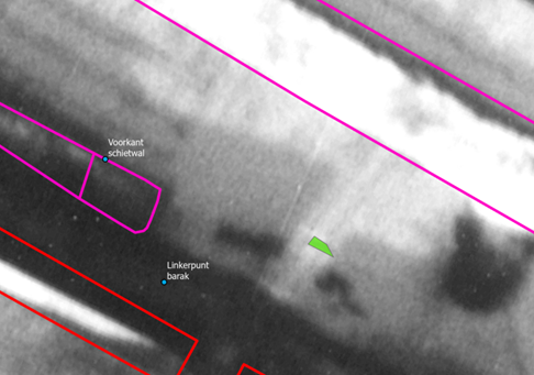
This analysis demonstrates how spatial methods can contribute to historical research. By combining historical photographs with map data and GIS analysis, it is possible to reconstruct a location in a well-founded way, even when the available sources are limited or incomplete.
Kamp Amersfoort
The National Monument Kamp Amersfoort Foundation keeps the memory of the camp and its victims alive, so that future generations can learn from it. The foundation faces the difficult task of reconstructing the past from scattered documents, some of which were thought to be lost. Every detail can be decisive in locating crucial elements of this turbulent past.